Discover the Ottawa River Waterfront Trail in Clarence-Rockland
Quick Tip
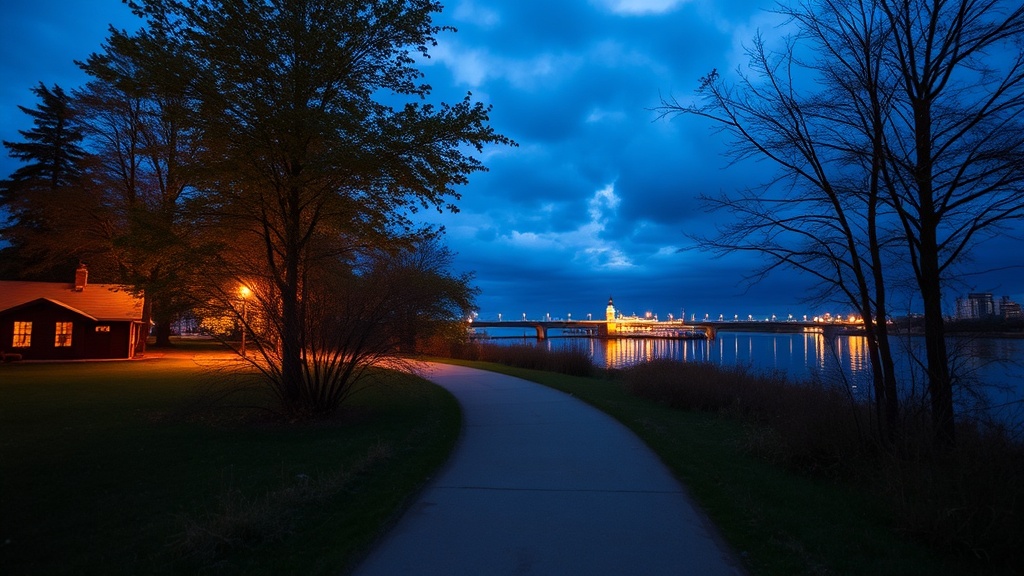
Visit the waterfront trail during weekday evenings around 7 PM in summer to catch spectacular sunsets with fewer crowds and cooler temperatures.
What makes the Ottawa River Waterfront Trail worth visiting?
The Ottawa River Waterfront Trail delivers 10 kilometres of paved pathways connecting Orleans to Pointe-Fortune—right through Clarence-Rockland. Whether you're into morning jogs, weekend bike rides, or sunset strolls, this trail offers river views without the downtown crowds. The route hugs the shoreline, passes through heritage villages, and connects to parks with picnic spots you'll actually want to use.
Where exactly does the trail go?
The Clarence-Rockland section runs from the Chutes-A-Papineau conservation area eastward through Rockland, Clarence, and into Cheney. You'll find four main access points:
- Chutes-A-Papineau — Parking off County Road 23, washrooms, waterfall views
- Optimiste Park (Rockland) — Playground, benches, easiest parking
- Eastmeath Park — Quiet stretch, fewer cyclists, good for dogs
- Clarence Creek — Links to village shops and the Clarence-Rockland municipal centre
The path is mostly flat asphalt—wheelchair and stroller friendly. That said, the eastern stretch near Cheney gets narrower and bumpier. If you're on road bikes, stick to the western half.
What activities work best here?
Cycling dominates on weekends. The trail connects to the broader Ottawa River Waterfront Trail network—meaning you can ride from Petrie Island all the way to Grenville without touching a road. Runners hit it early (before 8 AM) to avoid the dog-walking rush.
Fishing access points dot the route—bring your licence. The Ontario Ministry of Natural Resources stocks the river with walleye and muskie. You'll see locals casting near the hydro dam at Chutes-A-Papineau most evenings.
Trail surface comparison
| Section | Surface | Best for | Crowd level |
|---|---|---|---|
| Chutes-A-Papineau to Rockland | Asphalt, 3m wide | Road bikes, strollers | Moderate |
| Rockland to Eastmeath | Asphalt, 2.5m wide | Runners, casual cycling | Light |
| Eastmeath to Cheney | Crushed stone | Mountain bikes, hiking | Minimal |
What should you bring?
Water fountains exist at Optimiste Park and the municipal centre—nowhere else. Pack a bottle. The Ontario Parks guidelines suggest bug spray in June and July (the river marsh breeds mosquitoes).
Cell coverage drops near Chutes-A-Papineau. Download offline maps beforehand—or just follow the river. You can't get truly lost.
Winter changes everything. The trail becomes a snowshoe and cross-country ski route once the first heavy snow hits. The city doesn't plow it—locals pack down the path naturally. Ice grips help on the shaded sections near the creek.